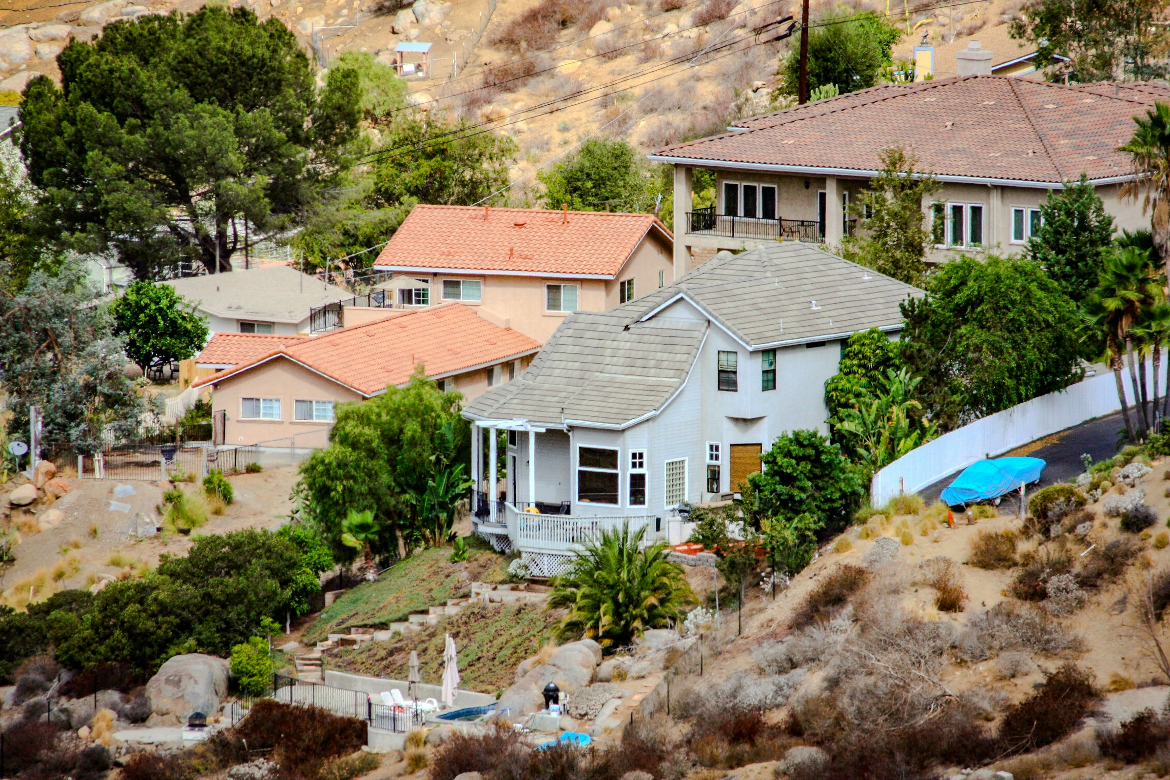
Stand on certain streets in California and you can look at two nearly identical houses — same hillside, same brush, same wind — that sell for measurably different prices. Nothing physical separates them. What separates them is a boundary on a state hazard map, and which side of it each house happens to sit on.
A natural experiment on the hazard line
California's fire-hazard maps come with an odd seam in them. In the territory where the state runs fire protection, sellers have long been required to disclose a home's wildfire-hazard designation in writing before closing on a sale. Step across into locally protected territory and — until recently — no such requirement attached, even where the mapped hazard tier was exactly the same. Same fire risk on paper; different paperwork when sold.
Economists at Resources for the Future treated that seam as a natural experiment. Working from the universe of California single-family sales from 2015 through 2022, they compared homes near those boundaries — all in the same high-hazard tier, differing only in whether the risk had to be put in front of the buyer in writing.
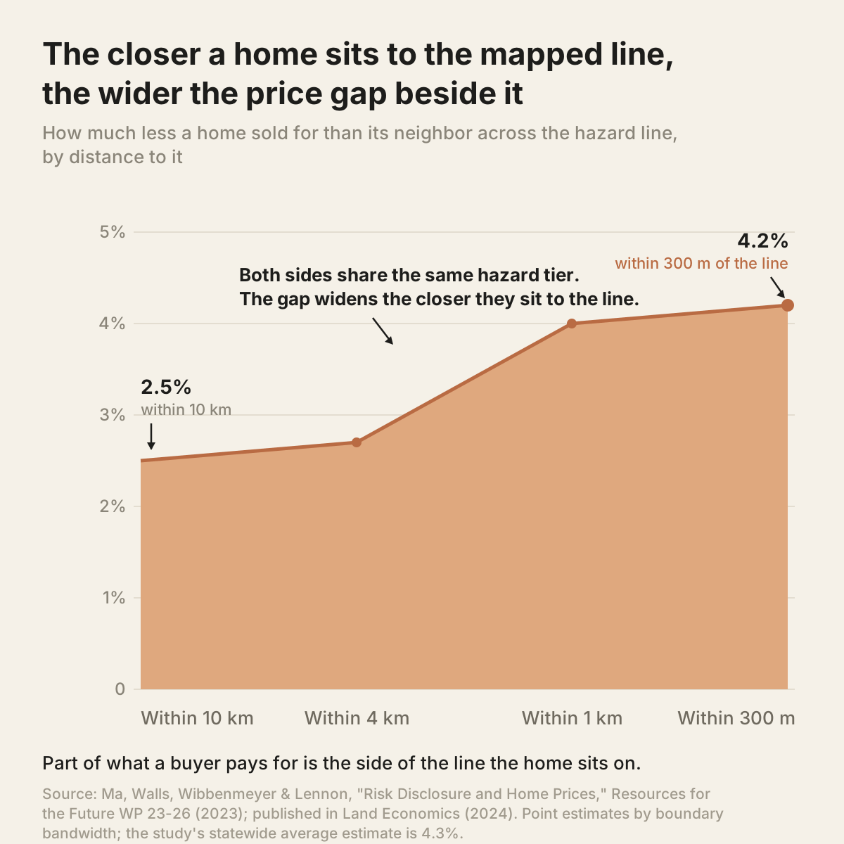
The result: homes carrying the disclosure requirement sold for about 4.3 percent less on average. Against the $557,000 median value near those boundaries, the authors put the gap at roughly $23,700. In Southern California the effect ran closer to 6 percent. And the estimated discount widened as the comparison tightened toward the line itself — from about 2.5 percent using homes within 10 kilometers to about 4.2 percent within 300 meters — exactly what you would see if the boundary itself, rather than the terrain, were doing the pricing.
The line moved in 2025
A boundary that prices houses would matter less if it held still. It does not. Between February and March 2025, CAL FIRE's Office of the State Fire Marshal issued its first full rewrite of the local-responsibility hazard maps since 2007. The new maps reclassified roughly 1.4 million acres upward into the two highest tiers — and, for the first time, drew "High" and "Moderate" zones inside cities and towns, where previously only "Very High" was mapped. Parcels that had never carried a designation acquired one with the stroke of a publication date.
What a designation carries
A hazard designation is not a label; it is a bundle of obligations. Fire-resistant construction standards. Defensible-space maintenance. And at sale, the risk goes into writing before closing. Since July 1, 2025, sellers of pre-2010 homes in the higher tiers owe buyers one more document: the state's list of inexpensive hardening measures, annotated to show which are already done.
The newest obligation is also the smallest, physically. On August 19, 2026, California's Board of Forestry approved the nation's first "Zone 0" rule for the highest-hazard areas: the five feet immediately around a structure must hold nothing that burns — no bark mulch, no woodpile, no wooden fence touching the wall. As of mid-September 2026 the rule is still in final administrative review, and existing homes will get years to phase in compliance. New construction comes first.
Which side of the line
I should be careful about what the study does and does not say. In Northern California, the researchers could not distinguish the effect from zero. And a disclosure that tells a buyer the truth about risk arguably makes the market more honest, not less — the same argument I've made about insurance quotes as climate forecasts. But my read is that the disclosure rule, the building standards, and the ember zone all share one property: each one attaches its costs, and its warning, to a parcel at the moment a line is drawn around it.
For a buyer, that changes what the number on the listing is made of. Some fraction of it is not the house — not the roof, not the lot, not the school district — but the parcel's position against a boundary the state can redraw. The owner pulled inside a new zone in 2025 holds the same house they held in 2024. Nothing on the property moved. The line moved. And the line, it turns out, is part of the price.
Sources
- Ma, Walls, Wibbenmeyer and Lennon, "Risk Disclosure and Home Prices: Evidence from California Wildfire Hazard Zones," Resources for the Future Working Paper 23-26, June 2023; published in Land Economics 100(1): 6–21, 2024. Average effect ~4.3 percent; median home value near the regulatory boundary $557,000, implying roughly $23,700; ~6 percent in Southern California at the 300-meter bandwidth; Northern California estimates not statistically distinguishable from zero; bandwidth estimates from ~2.5 percent (10 km) to ~4.2 percent (300 m).
- CAL FIRE Office of the State Fire Marshal, Fire Hazard Severity Zones, 2025 Local Responsibility Area maps released in four phases, February 10 – March 24, 2025; first full revision since 2007; roughly 1.4 million acres added to the High and Very High tiers; Moderate and High zones mapped in LRAs for the first time.
- California AB 38 (2019), Civil Code §1102.6f — fire-hardening disclosure for pre-2020 homes in High and Very High zones; on and after July 1, 2025, sellers of homes built before 2010 must also disclose completed low-cost retrofits from the State Fire Marshal's list.
- California Wildfire & Forest Resilience Task Force, "California Board of Forestry Approves First-in-the-Nation Zone 0 Defensible Space Regulations," August 2026. Final draft approved August 19, 2026; ember-resistant zone in the first five feet; phased implementation for existing homes; regulation pending administrative review as of September 2026.
Figures current as of September 2026.